Author: capebasc.online

  • Amazon Rainforest,

    The Amazon rainforest,[a] also called Amazon jungle or Amazonia, is a moist broadleaf tropical rainforest in the Amazon biome that covers most of the Amazon basin of South America. This basin encompasses 7,000,000 km2 (2,700,000 sq mi),[2] of which 6,000,000 km2 (2,300,000 sq mi) are covered by the rainforest.[3] This region includes territory belonging to nine nations and 3,344 indigenous territories.

    The majority of the forest, 60%, is in Brazil, followed by Peru with 13%, Colombia with 10%, and with minor amounts in BoliviaEcuadorFrench GuianaGuyanaSuriname, and Venezuela. Four nations have “Amazonas” as the name of one of their first-level administrative regions, and France uses the name “Guiana Amazonian Park” for French Guiana’s protected rainforest area. The Amazon represents over half of the total area of remaining rainforests on Earth,[4] and comprises the largest and most biodiverse tract of tropical rainforest in the world, with an estimated 390 billion individual trees in about 16,000 species.[5]

    More than 30 million people of 350 different ethnic groups live in the Amazon, which are subdivided into 9 different national political systems and 3,344 formally acknowledged indigenous territories. Indigenous peoples make up 9% of the total population, and 60 of the groups remain largely isolated.[6]

    Large scale deforestation is occurring in the forest, creating different harmful effects. Economic losses due to deforestation in Brazil could be approximately 7 times higher in comparison to the cost of all commodities produced through deforestation. In 2023, the World Bank published a report proposing a non-deforestation based economic program in the region.[7][8]

    Etymology

    The name Amazon is said to arise from a war Francisco de Orellana fought with the Tapuyas and other tribes. The women of the tribe fought alongside the men, as was their custom.[9] Orellana derived the name Amazonas from the Amazons of Greek mythology, described by Herodotus and Diodorus.[9]

    History

    See also: History of South America § Amazon, and Amazon River § History

    Bates‘s 1863 The Naturalist on the River Amazons
    Manaus, with 2.2 million inhabitants, is the largest city in the Amazon basin
    The Yanomami are a group of approximately 32,000 indigenous people who live in the Amazon rainforest.[10]
    Members of an uncontacted tribe encountered in the Brazilian state of Acre in 2009
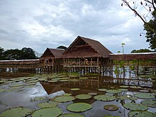
    Ribeirinhos dwellings. Ribeirinhos are a traditional rural non-indigenous[b] population in the Amazon rainforest, who live near rivers

    Based on archaeological evidence from an excavation at Caverna da Pedra Pintada, human inhabitants first settled in the Amazon region at least 11,200 years ago.[11] Subsequent development led to late-prehistoric settlements along the periphery of the forest by AD 1250, which induced alterations in the forest cover.[12]

    For a long time, it was thought that the Amazon rainforest was never more than sparsely populated, as it was impossible to sustain a large population through agriculture given the poor soil. Archeologist Betty Meggers was a prominent proponent of this idea, as described in her book Amazonia: Man and Culture in a Counterfeit Paradise. She claimed that a population density of 0.2 inhabitants per square kilometre (0.52/sq mi) is the maximum that can be sustained in the rainforest through hunting, with agriculture needed to host a larger population.[13] However, recent anthropological findings have suggested that the region was actually densely populated.[14] The Upano Valley sites in present-day eastern Ecuador predate all known complex Amazonian societies.[15]

    Some 5 million people may have lived in the Amazon region in AD 1500, divided between dense coastal settlements, such as that at Marajó, and inland dwellers.[16] Based on projections of food production, one estimate suggests over 8 million people living in the Amazon in 1492.[17] By 1900, the native indigenous population had fallen to 1 million and by the early 1980s it was less than 200,000.[16]

    The first European to travel the length of the Amazon River was Francisco de Orellana in 1542.[18] The BBC’s Unnatural Histories presents evidence that Orellana, rather than exaggerating his claims as previously thought, was correct in his observations that a complex civilization was flourishing along the Amazon in the 1540s. The Pre-Columbian agriculture in the Amazon Basin was sufficiently advanced to support prosperous and populous societies. It is believed that civilization was later devastated by the spread of diseases from Europe, such as smallpox.[19] This civilization was investigated by the British explorer Percy Fawcett in the early twentieth century. The results of his expeditions were inconclusive, and he disappeared mysteriously on his last trip. His name for this lost civilization was the City of Z.[citation needed]

    Since the 1970s, numerous geoglyphs have been discovered on deforested land dating between AD 1–1250, furthering claims about Pre-Columbian civilizations.[20][21] Ondemar Dias is accredited with first discovering the geoglyphs in 1977, and Alceu Ranzi is credited with furthering their discovery after flying over Acre.[19][22] The BBC’s Unnatural Histories presented evidence that the Amazon rainforest, rather than being a pristine wilderness, has been shaped by man for at least 11,000 years through practices such as forest gardening and terra preta.[19] Terra preta is found over large areas in the Amazon forest; and is now widely accepted as a product of indigenous soil management. The development of this fertile soil allowed agriculture and silviculture in the previously hostile environment; meaning that large portions of the Amazon rainforest are probably the result of centuries of human management, rather than naturally occurring as has previously been supposed.[23] In the region of the Xingu tribe, remains of some of these large settlements in the middle of the Amazon forest were found in 2003 by Michael Heckenberger and colleagues of the University of Florida. Among those were evidence of roads, bridges and large plazas.[24]

    In the Amazonas, there has been fighting and wars between the neighboring tribes of the Jivaro. Several tribes of the Jivaroan group, including the Shuar, practised headhunting for trophies and headshrinking.[25] The accounts of missionaries to the area in the borderlands between Brazil and Venezuela have recounted constant infighting in the Yanomami tribes. More than a third of the Yanomamo males, on average, died from warfare.[26][when?]

    The Munduruku were a warlike tribe that expanded along the Tapajós river and its tributaries and were feared by neighboring tribes. In the early 19th century, the Munduruku were pacified and subjugated by the Brazilians.[27]

    During the Amazon rubber boom it is estimated that diseases brought by immigrants, such as typhus and malaria, killed 40,000 native Amazonians.[28]

    In the 1950s, Brazilian explorer and defender of indigenous people, Cândido Rondon, supported the Villas-Bôas brothers‘ campaign, which faced strong opposition from the government and the ranchers of Mato Grosso and led to the establishment of the first Brazilian National Park for indigenous people along the Xingu River in 1961.[29]

    In 1961, British explorer Richard Mason was killed by an uncontacted Amazon tribe known as the Panará.[30]

    The Matsés made their first permanent contact with the outside world in 1969. Before that date, they were effectively at-war with the Peruvian government.[31]

    Geography

    Location

    Nine countries share the Amazon basin—most of the rainforest, 58.4%, is contained within the borders of Brazil. The other eight countries are Peru with 12.8%, Bolivia with 7.7%, Colombia with 7.1%, Venezuela with 6.1%, Guyana with 3.1%, Suriname with 2.5%, French Guiana with 1.4% and Ecuador with 1%.[32]

    Natural
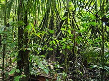
    Amazon rainforest in Colombia
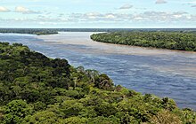
    Aerial view of the Amazon rainforest, near Manaus

    The rainforest likely formed during the Eocene era (from 56 million years to 33.9 million years ago). It appeared following a global reduction of tropical temperatures when the Atlantic Ocean had widened sufficiently to provide a warm, moist climate to the Amazon basin. The rainforest has been in existence for at least 55 million years, and most of the region remained free of savanna-type biomes at least until the current ice age when the climate was drier and savanna more widespread.[33][34]

    Following the Cretaceous–Paleogene extinction event, the extinction of the dinosaurs and the wetter climate may have allowed the tropical rainforest to spread out across the continent. From 66 to 34 Mya, the rainforest extended as far south as 45°. Climate fluctuations during the last 34 million years have allowed savanna regions to expand into the tropics. During the Oligocene, for example, the rainforest spanned a relatively narrow band. It expanded again during the Middle Miocene, then retracted to a mostly inland formation at the last glacial maximum.[35] However, the rainforest still managed to thrive during these glacial periods, allowing for the survival and evolution of a broad diversity of species.[36]

    Aerial view of the Amazon rainforest

    During the mid-Eocene, it is believed that the drainage basin of the Amazon was split along the middle of the continent by the Purus Arch. Water on the eastern side flowed toward the Atlantic, while to the west water flowed toward the Pacific across the Amazonas Basin. As the Andes Mountains rose, however, a large basin was created that enclosed a lake; now known as the Solimões Basin. Within the last 5–10 million years, this accumulating water broke through the Purus Arch, joining the easterly flow toward the Atlantic.[37][38]

    Aerial view of the Amazon rainforest near Manaus

    There is evidence that there have been significant changes in the Amazon rainforest vegetation over the last 21,000 years through the last glacial maximum (LGM) and subsequent deglaciation. Analyses of sediment deposits from Amazon basin paleolakes and the Amazon Fan indicate that rainfall in the basin during the LGM was lower than for the present, and this was almost certainly associated with reduced moist tropical vegetation cover in the basin.[39] In present day, the Amazon receives approximately 9 feet of rainfall annually. There is a debate, however, over how extensive this reduction was. Some scientists argue that the rainforest was reduced to small, isolated refugia separated by open forest and grassland;[40] other scientists argue that the rainforest remained largely intact but extended less far to the north, south, and east than is seen today.[41] This debate has proved difficult to resolve because the practical limitations of working in the rainforest mean that data sampling is biased away from the center of the Amazon basin, and both explanations are reasonably well supported by the available data.

    Sahara Desert dust windblown to the Amazon

    More than 56% of the dust fertilizing the Amazon rainforest comes from the Bodélé depression in Northern Chad in the Sahara desert. The dust contains phosphorus, important for plant growth. The yearly Sahara dust replaces the equivalent amount of phosphorus washed away yearly in Amazon soil from rains and floods.[42]

    NASA’s CALIPSO satellite has measured the amount of dust transported by wind from the Sahara to the Amazon: an average of 182 million tons of dust are windblown out of the Sahara each year (some dust falls into the Atlantic), 15% of which of falls over the Amazon basin (22 million tons of it consisting of phosphorus).[43]

    CALIPSO uses a laser range finder to scan the Earth’s atmosphere for the vertical distribution of dust and other aerosols. and regularly tracks the Sahara-Amazon dust plume. CALIPSO has measured variations in the dust amounts transported – an 86 percent drop between the highest amount of dust transported in 2007 and the lowest in 2011. This is possibly causing by rainfall variations is the Sahel, a strip of semi-arid land on the southern border of the Sahara..[44]

    Amazon phosphorus also comes as smoke due to biomass burning in Africa.[45][46]

    Biodiversity, flora and fauna

    See also: List of plants of Amazon Rainforest vegetation of Brazil and Amazonian manatee

    Deforestation in the Amazon rainforest threatens many species of tree frogs, which are very sensitive to environmental changes (pictured: giant leaf frog)
    A giant, bundled liana in western Brazil

    Wet tropical forests are the most species-rich biome, and tropical forests in the Americas are consistently more species rich than the wet forests in Africa and Asia.[47] As the largest tract of tropical rainforest in the Americas, the Amazonian rainforests have unparalleled biodiversity. One in ten known species in the world lives in the Amazon rainforest.[48] This constitutes the largest collection of living plants and animal species in the world.[49]

    The region is home to about 2.5 million insect species,[50] tens of thousands of plants, and some 2,000 birds and mammals. To date, at least 40,000 plant species,[51] 2,200 fishes,[52] 1,294 birds, 427 mammals, 428 amphibians, and 378 reptiles have been scientifically classified in the region.[53] One in five of all bird species are found in the Amazon rainforest, and one in five of the fish species live in Amazonian rivers and streams. Scientists have described between 96,660 and 128,843 invertebrate species in Brazil alone.[54]

    The biodiversity of plant species is the highest on Earth with one 2001 study finding a quarter square kilometer (62 acres) of Ecuadorian rainforest supports more than 1,100 tree species.[55] A study in 1999 found one square kilometer (247 acres) of Amazon rainforest can contain about 90,790 tonnes of living plants. The average plant biomass is estimated at 356 ± 47 tonnes per hectare.[56] To date, an estimated 438,000 species of plants of economic and social interest have been registered in the region with many more remaining to be discovered or catalogued.[57] The total number of tree species in the region is estimated at 16,000.[5]

    The green leaf area of plants and trees in the rainforest varies by about 25% as a result of seasonal changes. Leaves expand during the dry season when sunlight is at a maximum, then undergo abscission in the cloudy wet season. These changes provide a balance of carbon between photosynthesis and respiration.[58]

    Each hectare of the Amazon rainforest contains around 1 billion of invertebrates. The amount of species per hectare in the Amazon rainforest can be presented in the next table:[59]

    Type of organismNumber of species per hectare
    Birds160
    Trees310
    Epiphytes96
    Reptile22
    Amphibians33
    Fish44
    Primates10

    The rainforest contains several species that can pose a hazard. Among the largest predatory creatures are the black caimanjaguarcougar, and anaconda. In the river, electric eels can produce an electric shock that can stun or kill, while piranha are known to bite and injure humans.[60] Various species of poison dart frogs secrete lipophilic alkaloid toxins through their flesh. There are also numerous parasites and disease vectors. Vampire bats dwell in the rainforest and can spread the rabies virus.[61] Malariayellow fever and dengue fever can also be contracted in the Amazon region.

    The biodiversity in the Amazon is becoming increasingly threatened, primarily by habitat loss from deforestation as well as increased frequency of fires. Over 90% of Amazonian plant and vertebrate species (13,000–14,000 in total) may have been impacted to some degree by fires.[62]

    Deforestation

    Main article: Deforestation of the Amazon rainforest

    See also: Trans-Amazonian Highway and Trans-Amazonian Railway

    Timelapse of the deforestation 1984–2018 (bottom right)

    Deforestation in the Maranhão state of Brazil, 2016

    Wildfires in Brazil’s indigenous territory, 2017

    Home to much of the Amazon rainforest, Brazil’s tropical primary (old-growth) forest loss greatly exceeds that of other countries.[63]
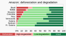
    Overall, 20% of the Amazon rainforest has been “transformed” (deforested) and another 6% has been “highly degraded”, causing Amazon Watch to warn that the Amazonia is in the midst of a tipping point crisis.[64]

    Deforestation is the conversion of forested areas to non-forested areas. The main sources of deforestation in the Amazon are human settlement and the development of the land.[65] In 2022, about 20% of the Amazon rainforest has already been deforested and a further 6% was “highly degraded”.[66] Research suggests that upon reaching about 20–25% (hence 0–5% more), the tipping point to flip it into a non-forest ecosystem – degraded savannah – (in eastern, southern and central Amazonia) will be reached.[67][68][69] This process of savanisation would take decades to take full effect.[66]

    Prior to the early 1960s, access to the forest’s interior was highly restricted, and the forest remained basically intact.[70] Farms established during the 1960s were based on crop cultivation and the slash and burn method. However, the colonists were unable to manage their fields and the crops because of the loss of soil fertility and weed invasion.[71] The soils in the Amazon are productive for just a short period of time, so farmers are constantly moving to new areas and clearing more land.[71] These farming practices led to deforestation and caused extensive environmental damage.[72] Deforestation is considerable, and areas cleared of forest are visible to the naked eye from outer space.

    In the 1970s, construction began on the Trans-Amazonian highway. This highway represented a major threat to the Amazon rainforest.[73] The highway still has not been completed, limiting the environmental damage.

    Between 1991 and 2000, the total area of forest lost in the Amazon rose from 415,000 to 587,000 km2 (160,000 to 227,000 sq mi), with most of the lost forest becoming pasture for cattle.[74] Seventy percent of formerly forested land in the Amazon, and 91% of land deforested since 1970, have been used for livestock pasture.[75][76] Currently, Brazil is the largest global producer of soybeans. New research however, conducted by Leydimere Oliveira et al., has shown that the more rainforest is logged in the Amazon, the less precipitation reaches the area and so the lower the yield per hectare becomes. So despite the popular perception, there has been no economical advantage for Brazil from logging rainforest zones and converting these to pastoral fields.[77]

    Indigenous protesters from Vale do Javari

    The needs of soy farmers have been used to justify many of the controversial transportation projects that are currently developing in the Amazon. The first two highways successfully opened up the rainforest and led to increased settlement and deforestation. The mean annual deforestation rate from 2000 to 2005 (22,392 km2 or 8,646 sq mi per year) was 18% higher than in the previous five years (19,018 km2 or 7,343 sq mi per year).[78] Although deforestation declined significantly in the Brazilian Amazon between 2004 and 2014, there has been an increase to the present day.[79]

    Brazilian mining operation in the Amazon Rainforest.

    Brazil’s President, Jair Bolsonaro, has supported the relaxation of regulations placed on agricultural land. He has used his time in office to allow for more deforestation and more exploitation of the Amazon’s rich natural resources. Deforestation reached a 15 year high in 2021.[80]

    Since the discovery of fossil fuel reservoirs in the Amazon rainforest, oil drilling activity has steadily increased, peaking in the Western Amazon in the 1970s and ushering another drilling boom in the 2000s.[81] Oil companies have to set up their operations by opening new roads through the forests, which often contributes to deforestation in the region.[82] 9.4% of the territory of the Amazon is affected by oil fields.[83]

    Mining is also a major driver of deforestation. 17% of the area of the Amazon Rainforest is affected by mining.[83]

    The transition to solar and wind energy, digitalization, raised the demand for cassiterite (the main ore of tin used also for financing gold mining), manganese and copper, which attracrted many illegal miners to the Amazon. This led to deforestation, different environmental and social problems. Hydropower also creates significant problems in the Amazon. Such activities are defined by the World Rainforest Movement as “Green extractivism“.[84][85]

    The European Union–Mercosur free trade agreement, which would form one of the world’s largest free trade areas, has been denounced by environmental activists and indigenous rights campaigners.[86] The fear is that the deal could lead to more deforestation of the Amazon rainforest as it expands market access to Brazilian beef.[87]

    According to a November 2021 report by Brazil’s INPE, based on satellite data, deforestation has increased by 22% over 2020 and is at its highest level since 2006.[88][89]

    2019 fires

    Main article: 2019 Amazon rainforest wildfires

    There were 72,843 fires in Brazil in 2019, with more than half within the Amazon region.[90][91][92] In August 2019 there were a record number of fires.[93] Deforestation in the Brazilian Amazon rose more than 88% in June 2019 compared with the same month in 2018.[94]

    • NASA satellite observation of deforestation in the Mato Grosso state of Brazil. The transformation from forest to farm is evident by the paler square shaped areas under development.
    • Fires and deforestation in the state of Rondônia
    • One consequence of forest clearing in the Amazon: thick smoke that hangs over the forest
    • Impact of deforestation on natural habitat of trees

    The increased area of fire-impacted forest coincided with a relaxation of environmental regulations from the Brazilian government. Notably, before those regulations were put in place in 2008 the fire-impacted area was also larger compared to the regulation period of 2009–2018. As these fire continue to move closer to the heart of the Amazon basin, their impact on biodiversity will only increase in scale, as the cumulative fire-impacted area is correlated with the number of species impacted.[62]

    Conservation and climate change

    See also: Deforestation and climate changeGaviotas, and Amazon Fund

    Amazon rainforest

    Environmentalists are concerned about loss of biodiversity that will result from destruction of the forest, and also about the release of the carbon contained within the vegetation, which could accelerate global warming. Amazonian evergreen forests account for about 10% of the world’s terrestrial primary productivity and 10% of the carbon stores in ecosystems[95] – of the order of 1.1 × 10¹¹ metric tonnes of carbon.[96] Amazonian forests are estimated to have accumulated 0.62 ± 0.37 tons of carbon per hectare per year between 1975 and 1996.[96] In 2021 it was reported that the Amazon for the first time emitted more greenhouse gases than it absorbed.[97] Though often referenced as producing more than a quarter of the Earth’s oxygen, this often stated, but misused statistic actually refers to oxygen turnover. The net contribution of the ecosystem is approximately zero.[98]

    Tipping cascades in the Amazon rainforest, according to the 2023 Global Tipping Points report. Potential tipping points for the Amazon include a 3-4°C rise in global temperature and deforestation levels over 40%.[99]

    One computer model of future climate change caused by greenhouse gas emissions shows that the Amazon rainforest could become unsustainable under conditions of severely reduced rainfall and increased temperatures, leading to an almost complete loss of rainforest cover in the basin by 2100.,[100][101] and severe economic, natural capital and ecosystem services impacts of not averting the tipping point.[102] However, simulations of Amazon basin climate change across many different models are not consistent in their estimation of any rainfall response, ranging from weak increases to strong decreases.[103] The result indicates that the rainforest could be threatened through the 21st century by climate change in addition to deforestation.

    Peruvian researcher Tatiana Espinosa [es] with a Dipteryx micrantha tree in the Peruvian Amazonia

    In 1989, environmentalist C.M. Peters and two colleagues stated there is economic as well as biological incentive to protecting the rainforest. One hectare in the Peruvian Amazon has been calculated to have a value of $6820 if intact forest is sustainably harvested for fruits, latex, and timber; $1000 if clear-cut for commercial timber (not sustainably harvested); or $148 if used as cattle pasture.[104]

    A map of uncontacted tribes, around the start of the 21st century

    As indigenous territories continue to be destroyed by deforestation and ecocide (such as in the Peruvian Amazon),[105] indigenous peoples‘ rainforest communities continue to disappear, while others, like the Urarina continue to struggle to fight for their cultural survival and the fate of their forested territories. Meanwhile, the relationship between non-human primates in the subsistence and symbolism of indigenous lowland South American peoples has gained increased attention, as have ethno-biology and community-based conservation efforts.

    From 2002 to 2006, the conserved land in the Amazon rainforest almost tripled and deforestation rates dropped up to 60%. About 1,000,000 km2 (250,000,000 acres) have been put onto some sort of conservation, which adds up to a current amount of 1,730,000 km2 (430,000,000 acres).[106]

    In April 2019, the Ecuadorian court stopped oil exploration activities in 180,000 hectares (440,000 acres) of the Amazon rainforest.[107]

    In July 2019, the Ecuadorian court forbade the government to sell territory with forests to oil companies.[108]

    In September 2019, the US and Brazil agreed to promote private-sector development in the Amazon. They also pledged a $100m biodiversity conservation fund for the Amazon led by the private sector. Brazil’s foreign minister stated that opening the rainforest to economic development was the only way to protect it.[109]

    • Anthropogenic emission of greenhouse gases broken down by sector for the year 2000.
    • Aerosols over the Amazon each September for four burning seasons (2005 through 2008). The aerosol scale (yellow to dark reddish-brown) indicates the relative amount of particles that absorb sunlight.
    • Aerial roots of red mangrove on an Amazonian river.
    • Climate change disturbances of rainforests.[110]

    A 2009 study found that a 4 °C rise (above pre-industrial levels) in global temperatures by 2100 would kill 85% of the Amazon rainforest while a temperature rise of 3 °C would kill some 75% of the Amazon.[111]

    Guiana Amazonian Park in French Guiana

    A new study by an international team of environmental scientists in the Brazilian Amazon shows that protection of freshwater biodiversity can be increased by up to 600% through integrated freshwater-terrestrial planning .[112]

    Deforestation in the Amazon rainforest region has a negative impact on local climate.[113] It was one of the main causes of the severe drought of 2014–2015 in Brazil.[114][115] This is because the moisture from the forests is important to the rainfall in BrazilParaguay and Argentina. Half of the rainfall in the Amazon area is produced by the forests.[116]

    Results of a 2021 scientific synthesis indicate that, in terms of global warming, the Amazon basin with the Amazon rainforest is currently emitting more greenhouse gases than it absorbs overall. Climate change impacts and human activities in the area – mainly wildfires, current land-use and deforestation – are causing a release of forcing agents that likely result in a net warming effect.[117][110][118]

    In 2022 the supreme court of Ecuador decided that “”under no circumstances can a project be carried out that generates excessive sacrifices to the collective rights of communities and nature.” It also required the government to respect the opinion of Indigenous peoples of the Americas about different industrial projects on their land. Advocates of the decision argue that it will have consequences far beyond Ecuador. In general, ecosystems are in better shape when indigenous peoples own or manage the land.[119]

    Due to the conservation policies of Luiz Inácio Lula da Silva in the first 10 months of 2023 deforestation in the Brazilian Amazon decreased by around 50% compared to the same period in 2022. This was despite a severe drought, one of the worst on record, that exacerbated the situation. Climate change, El Nino, deforestation increases the likelihood of drought condition in the Amazon.[120]

    According to Amazon Conservation’s MAAP forest monitoring program, the deforestation rate in the Amazon from the January 1 to November 8, 2023, decreased by 56% in comparison to the same period in 2022. The main cause is the decline in deforestation rate in Brazil, due to the government’s policies, while Columbia, Peru and Bolivia also reduced deforestation.[121]

    In January 2024 published data showed a 50% decline in deforestation rate in the Amazon rainforest and 43% rise in vegetation loss in the neighbor Cerrado during the year of 2023 in comparison to 2022. Both biomes together lose 12,980 km², 18% less than in 2022.[122]

    Remote sensing

    See also: Environmental monitoringEnvironmental management system, and Unmanned aerial vehicle

    This image reveals how the forest and the atmosphere interact to create a uniform layer of “popcorn-shaped” cumulus clouds.

    The use of remotely sensed data is dramatically improving conservationists’ knowledge of the Amazon basin. Given the objectivity and lowered costs of satellite-based land cover and -change analysis, it appears likely that remote sensing technology will be an integral part of assessing the extents, locations and damage of deforestation in the basin.[123] Furthermore, remote sensing is the best and perhaps only possible way to study the Amazon on a large scale.[124]

    The use of remote sensing for the conservation of the Amazon is also being used by the indigenous tribes of the basin to protect their tribal lands from commercial interests. Using handheld GPS devices and programs like Google Earth, members of the Trio Tribe, who live in the rainforests of southern Suriname, map out their ancestral lands to help strengthen their territorial claims.[125] Currently, most tribes in the Amazon do not have clearly defined boundaries, making it easier for commercial ventures to target their territories.

    To accurately map the Amazon’s biomass and subsequent carbon-related emissions, the classification of tree growth stages within different parts of the forest is crucial. In 2006, Tatiana Kuplich organized the trees of the Amazon into four categories: mature forest, regenerating forest [less than three years], regenerating forest [between three and five years of regrowth], and regenerating forest [eleven to eighteen years of continued development].[126] The researcher used a combination of synthetic aperture radar (SAR) and Thematic Mapper (TM) to accurately place the different portions of the Amazon into one of the four classifications.

    Impact of early 21st-century Amazon droughts

    In 2005, parts of the Amazon basin experienced the worst drought in one hundred years,[127] and there were indications that 2006 may have been a second successive year of drought.[128] A 2006 article in the UK newspaper The Independent reported the Woods Hole Research Center results, showing that the forest in its present form could survive only three years of drought.[129][130] Scientists at the Brazilian National Institute of Amazonian Research argued in the article that this drought response, coupled with the effects of deforestation on regional climate, are pushing the rainforest towards a “tipping point” where it would irreversibly start to die.[131] It concluded that the forest is on the brink of[vague] being turned into savanna or desert, with catastrophic consequences for the world’s climate.[citation needed] A study published in Nature Communications in October 2020 found that about 40% of the Amazon rainforest is at risk of becoming a savanna-like ecosystem due to reduced rainfall.[132] A study published in Nature climate change provided direct empirical evidence that more than three-quarters of the Amazon rainforest has been losing resilience since the early 2000s, risking dieback with profound implications for biodiversity, carbon storage and climate change at a global scale.[133]

    According to the World Wide Fund for Nature, the combination of climate change and deforestation increases the drying effect of dead trees that fuels forest fires.[134]

    In 2010, the Amazon rainforest experienced another severe drought, in some ways more extreme than the 2005 drought. The affected region was approximately 3,000,000 km2 (1,160,000 sq mi) of rainforest, compared with 1,900,000 km2 (734,000 sq mi) in 2005. The 2010 drought had three epicenters where vegetation died off, whereas in 2005, the drought was focused on the southwestern part. The findings were published in the journal Science. In a typical year, the Amazon absorbs 1.5 gigatons of carbon dioxide; during 2005 instead 5 gigatons were released and in 2010 8 gigatons were released.[135][136] Additional severe droughts occurred in 2010, 2015, and 2016.[137]

    In 2019 Brazil’s protections of the Amazon rainforest were slashed, resulting in a severe loss of trees.[138] According to Brazil’s National Institute for Space Research (INPE), deforestation in the Brazilian Amazon rose more than 50% in the first three months of 2020 compared to the same three-month period in 2019.[139]

    In 2020, a 17 percent rise was noted in the Amazon wildfires, marking the worst start to the fire season in a decade. The first 10 days of August 2020 witnessed 10,136 fires. An analysis of the government figures reflected 81 per cent increase in fires in federal reserves, in comparison with the same period in 2019.[140] However, President Jair Bolsonaro turned down the existence of fires, calling it a “lie”, despite the data produced by his own government.[141] Satellites in September recorded 32,017 hotspots in the world’s largest rainforest, a 61% rise from the same month in 2019.[142] In addition, October saw a huge surge in the number of hotspots in the forest (more than 17,000 fires are burning in the Amazon’s rainforest) – with more than double the amount detected in the same month last year.[143]

    Possibility of forest-friendly economy

    In 2023 the World Bank, published a report named: “A Balancing Act for Brazil’s Amazonian States: An Economic Memorandum”. The report stating that economic losses due to deforestation in Brazil could reach around 317 billion dollars per year, approximately 7 times higher in comparison to the cost of all commodities produced through deforestation, proposed non-deforestation based economic program in the region of the Amazon rainforest.[7][8]

    Silvopasture integrates livestock, forage, and trees. (Photo: USDA NAC)

    Silvopasture (integrating trees, forage and grazing) can help to stop deforestation in the region.[144]

    According to WWF, ecotourism could help the Amazon to reduce deforestation and climate change. Ecotourism is currently still little practiced in the Amazon, partly due to lack of information about places where implementation is possible. Ecotourism is a sector that can also be taken up by the Indigenous community in the Amazon as a source of income and revenue. An ecotourism project in the Brazilian section of the rainforest had been under consideration by Brazil’s State Secretary for the Environment and Sustainable Development in 2009, along the Aripuanã River, in the Aripuanã Sustainable Development Reserve.[145] Also, some community-based ecotourism exists in the Mamirauá Sustainable Development Reserve.[146] Ecotourism is also practiced in the Peruvian section of the rainforest. A few ecolodges are for instance present between Cusco and Madre de Dios.[147]

    In May 2023 Brazil’s bank federation decided to implement a new sustainability standard demanding from meatpackers to ensure their meat is not coming from illegally deforested area. Credits will not be given to those who will not meet the new standards. The decision came after the European Union decides to implement regulations to stop deforestation. Brazil beef exporters, said the standard is not just because it is not applied to land owners.[148] 21 banks representing 81% of the credit market in Brazil agree to follow those rules.[149]

    According to a statement of the Colombian government deforestation rates in the Colombian Amazon fell by 70% in the first 9 months of 2023 compared to the same period in the previous year, what can be attributed to the conservation policies of the government. One of them is paying local residents for conserving the forest.[150]

  •  Amazon River

    The Amazon River (UK/ˈæməzən/US/ˈæməzɒn/SpanishRío AmazonasPortugueseRio Amazonas) in South America is the largest river by discharge volume of water in the world, and the longest or second-longest river system in the world, a title which is disputed with the Nile.[3][21][n 4]

    The headwaters of the Apurímac River on Nevado Mismi had been considered, for nearly a century, the Amazon basin‘s most distant source until a 2014 study found it to be the headwaters of the Mantaro River on the Cordillera Rumi Cruz in Peru.[26] The Mantaro and Apurímac rivers join, and with other tributaries form the Ucayali River, which in turn meets the Marañón River upstream of Iquitos, Peru, forming what countries other than Brazil consider to be the main stem of the Amazon. Brazilians call this section the Solimões River above its confluence with the Rio Negro[27] forming what Brazilians call the Amazon at the Meeting of Waters (PortugueseEncontro das Águas) at Manaus, the largest city on the river.

    The Amazon River has an average discharge of about 215,000–230,000 m3/s (7,600,000–8,100,000 cu ft/s)—approximately 6,591–7,570 km3 (1,581–1,816 cu mi) per year, greater than the next seven largest independent rivers combined. Two of the top ten rivers by discharge are tributaries of the Amazon river. The Amazon represents 20% of the global riverine discharge into oceans.[28] The Amazon basin is the largest drainage basin in the world, with an area of approximately 7,000,000 km2 (2,700,000 sq mi).[3] The portion of the river’s drainage basin in Brazil alone is larger than any other river’s basin. The Amazon enters Brazil with only one-fifth of the flow it finally discharges into the Atlantic Ocean, yet already has a greater flow at this point than the discharge of any other river in the world.[29][30]It has a length of 6,400 km (3977 miles) but according to some report its length varies from 7,025-7,100 km (4,365-4,410 miles).

    Etymology

    [edit]

    The Amazon was initially known by Europeans as the Marañón, and the Peruvian part of the river is still known by that name, as well as the Brazilian state of Maranhão, which contains part of the Amazon. It later became known as Rio Amazonas in Spanish and Portuguese.

    The name Rio Amazonas was reportedly given after native warriors attacked a 16th-century expedition by Francisco de Orellana. The warriors were led by women, reminding de Orellana of the Amazon warriors, a tribe of women warriors related to Iranian Scythians and Sarmatians[31][32] mentioned in Greek mythology. The word Amazon itself may be derived from the Iranian compound * ha-maz-an- “(one) fighting together”[33] or ethnonym * ha-mazan- “warriors”, a word attested indirectly through a derivation, a denominal verb in Hesychius of Alexandria‘s gloss “ἁμαζακάραν· πολεμεῖν. Πέρσαι” (“hamazakaran: ‘to make war’ in Persian”), where it appears together with the Indo-Iranian root * kar- “make” (from which Sanskrit karma is also derived).[34]

    Other scholars[who?] claim that the name is derived from the Tupi word amassona, meaning “boat destroyer”.[35][citation needed]

    History

    [edit]

    Main article: Timeline of Amazon history

    Geological history

    [edit]

    Recent geological studies suggest that for millions of years, the Amazon River flowed in the opposite direction – from east to west. Eventually the Andes Mountains formed, blocking its flow to the Pacific Ocean and causing it to switch directions to its current mouth in the Atlantic Ocean.[36]

    Pre-Columbian era

    [edit]

    Old drawing (from 1879) of Arapaima fishing at the Amazon river. The arapaima has been on Earth for at least 23 million years.[37]

    During what many archaeologists called the formative stage, Amazonian societies were deeply involved in the emergence of South America’s highland agrarian systems. The trade with Andean civilizations in the terrains of the headwaters in the Andes formed an essential contribution to the social and religious development of higher-altitude civilizations like the Muisca and Incas. Early human settlements were typically based on low-lying hills or mounds.

    Shell mounds were the earliest evidence of habitation; they represent piles of human refuse (waste) and are mainly dated between 7500 BC and 4000 BC. They are associated with ceramic age cultures; no preceramic shell mounds have been documented so far by archaeologists.[38] Artificial earth platforms for entire villages are the second type of mounds. They are best represented by the Marajoara cultureFigurative mounds are the most recent types of occupation.

    There is ample evidence that the areas surrounding the Amazon River were home to complex and large-scale indigenous societies, mainly chiefdoms who developed towns and cities.[39] Archaeologists estimate that by the time the Spanish conquistador De Orellana traveled across the Amazon in 1541, more than 3 million indigenous people lived around the Amazon.[40]: 24–25  These pre-Columbian settlements created highly developed civilizations. For instance, pre-Columbian indigenous people on the island of Marajó may have developed social stratification and supported a population of 100,000 people. To achieve this level of development, the indigenous inhabitants of the Amazon rainforest altered the forest’s ecology by selective cultivation and the use of fire. Scientists argue that by burning areas of the forest repeatedly, the indigenous people caused the soil to become richer in nutrients. This created dark soil areas known as terra preta de índio (“Indian dark earth”).[40]: 25  Because of the terra preta, indigenous communities were able to make land fertile and thus sustainable for the large-scale agriculture needed to support their large populations and complex social structures. Further research has hypothesized that this practice began around 11,000 years ago. Some say that its effects on forest ecology and regional climate explain the otherwise inexplicable band of lower rainfall through the Amazon basin.[40]: 25 

    Many indigenous tribes engaged in constant warfare. According to James S. Olson, “The Munduruku expansion (in the 18th century) dislocated and displaced the Kawahíb, breaking the tribe down into much smaller groups … [Munduruku] first came to the attention of Europeans in 1770 when they began a series of widespread attacks on Brazilian settlements along the Amazon River.”[41]

    Arrival of Europeans

    [edit]

    Amazon tributaries near Manaus

    In March 1500, Spanish conquistador Vicente Yáñez Pinzón was the first documented European to sail up the Amazon River.[42] Pinzón called the stream Río Santa María del Mar Dulce, later shortened to Mar Dulce, literally, sweet sea, because of its freshwater pushing out into the ocean. Another Spanish explorer, Francisco de Orellana, was the first European to travel from the origins of the upstream river basins, situated in the Andes, to the mouth of the river. In this journey, Orellana baptized some of the affluents of the Amazonas like Rio NegroNapo and Jurua. The name Amazonas is thought to be taken from the native warriors that attacked this expedition, mostly women, that reminded De Orellana of the mythical female Amazon warriors from the ancient Hellenic culture in Greece (see also Origin of the name).

    Exploration

    [edit]

    Samuel Fritz‘s 1707 map showing the Amazon and the Orinoco

    Gonzalo Pizarro set off in 1541 to explore east of Quito into the South American interior in search of El Dorado, the “city of gold” and La Canela, the “valley of cinnamon“.[43] He was accompanied by his second-in-command Francisco de Orellana. After 170 km (106 mi), the Coca River joined the Napo River (at a point now known as Puerto Francisco de Orellana); the party stopped for a few weeks to build a boat just upriver from this confluence. They continued downriver through an uninhabited area, where they could not find food. Orellana offered and was ordered to follow the Napo River, then known as Río de la Canela (“Cinnamon River”), and return with food for the party. Based on intelligence received from a captive native chief named Delicola, they expected to find food within a few days downriver by ascending another river to the north.

    De Orellana took about 57 men, the boat, and some canoes and left Pizarro’s troops on 26 December 1541. However, De Orellana missed the confluence (probably with the Aguarico) where he was searching supplies for his men. By the time he and his men reached another village, many of them were sick from hunger and eating “noxious plants”, and near death. Seven men died in that village. His men threatened to mutiny if the expedition turned back to attempt to rejoin Pizarro, the party being over 100 leagues downstream at this point. He accepted to change the purpose of the expedition to discover new lands in the name of the king of Spain, and the men built a larger boat in which to navigate downstream. After a journey of 600 km (370 mi) down the Napo River, they reached a further major confluence, at a point near modern Iquitos, and then followed the upper Amazon, now known as the Solimões, for a further 1,200 km (746 mi) to its confluence with the Rio Negro (near modern Manaus), which they reached on 3 June 1542.

    Regarding the initial mission of finding cinnamon, Pizarro reported to the king that they had found cinnamon trees, but that they could not be profitably harvested. True cinnamon (Cinnamomum Verum) is not native to South America. Other related cinnamon-containing plants (of the family Lauraceae) are fairly common in that part of the Amazon and Pizarro probably saw some of these. The expedition reached the mouth of the Amazon on 24 August 1542, demonstrating the practical navigability of the Great River.

    Masked-dance, and wedding-feast of Ticuna Indians, engravings for Bates’s 1863 The Naturalist on the River Amazons

    In 1560, another Spanish conquistadorLope de Aguirre, may have made the second descent of the Amazon. Historians are uncertain whether the river he descended was the Amazon or the Orinoco River, which runs more or less parallel to the Amazon further north.

    Portuguese explorer Pedro Teixeira was the first European to travel up the entire river. He arrived in Quito in 1637, and returned via the same route.[44]

    From 1648 to 1652, Portuguese Brazilian bandeirante António Raposo Tavares led an expedition from São Paulo overland to the mouth of the Amazon, investigating many of its tributaries, including the Rio Negro, and covering a distance of over 10,000 km (6,200 mi).

    In what is currently in Brazil, Ecuador, Bolivia, Colombia, Peru, and Venezuela, several colonial and religious settlements were established along the banks of primary rivers and tributaries for trade, slaving[citation needed] , and evangelization among the indigenous peoples of the vast rainforest, such as the Urarina. In the late 1600s, Czech Jesuit Father Samuel Fritz, an apostle of the Omagus established some forty mission villages. Fritz proposed that the Marañón River must be the source of the Amazon, noting on his 1707 map that the Marañón “has its source on the southern shore of a lake that is called Lauricocha, near Huánuco.” Fritz reasoned that the Marañón is the largest river branch one encounters when journeying upstream, and lies farther to the west than any other tributary of the Amazon. For most of the 18th–19th centuries and into the 20th century, the Marañón was generally considered the source of the Amazon.[45]

    Henry Walter Bates was most famous for his expedition to the Amazon (1848–1859).

    Scientific exploration

    [edit]

    Early scientific, zoological, and botanical exploration of the Amazon River and basin took place from the 18th century through the first half of the 19th century.

    Post-colonial exploitation and settlement

    [edit]

    Amazonas state
    Amazon Theatre opera house in Manaus built in 1896 during the rubber boom

    Amazon Theatre opera house in Manaus built in 1896 during the rubber boom

    Metropolitan Cathedral of Santarém, in Santarém, Brazil

    Metropolitan Cathedral of Santarém, in Santarém, Brazil

    Iglesia Matriz in Iquitos, Peru

    The Cabanagem revolt (1835–1840) was directed against the white ruling class. It is estimated that from 30% to 40% of the population of Grão-Pará, estimated at 100,000 people, died.[47]

    The population of the Brazilian portion of the Amazon basin in 1850 was perhaps 300,000, of whom about 175,000 were Europeans and 25,000 were slaves. The Brazilian Amazon’s principal commercial city, Pará (now Belém), had from 10,000 to 12,000 inhabitants, including slaves. The town of Manáos, now Manaus, at the mouth of the Rio Negro, had a population between 1,000 and 1,500. All the remaining villages, as far up as Tabatinga, on the Brazilian frontier of Peru, were relatively small.[48]

    On 6 September 1850, Emperor Pedro II of Brazil sanctioned a law authorizing steam navigation on the Amazon and gave the Viscount of Mauá (Irineu Evangelista de Sousa) the task of putting it into effect. He organised the “Companhia de Navegação e Comércio do Amazonas” in Rio de Janeiro in 1852; in the following year it commenced operations with four small steamers, the Monarca (‘Monarch’), the Cametá, the Marajó and the Rio Negro.[48][49]

    At first, navigation was principally confined to the main river; and even in 1857 a modification of the government contract only obliged the company to a monthly service between Pará and Manaus, with steamers of 200 tons cargo capacity, a second line to make six round voyages a year between Manaus and Tabatinga, and a third, two trips a month between Pará and Cametá.[48] This was the first step in opening up the vast interior.

    The success of the venture called attention to the opportunities for economic exploitation of the Amazon, and a second company soon opened commerce on the Madeira, Purús, and Negro; a third established a line between Pará and Manaus, and a fourth found it profitable to navigate some of the smaller streams. In that same period, the Amazonas Company was increasing its fleet. Meanwhile, private individuals were building and running small steam craft of their own on the main river as well as on many of its tributaries.[48]

    On 31 July 1867, the government of Brazil, constantly pressed by the maritime powers and by the countries encircling the upper Amazon basin, especially Peru, decreed the opening of the Amazon to all countries, but they limited this to certain defined points: Tabatinga – on the Amazon; Cametá – on the Tocantins; Santarém – on the Tapajós; Borba – on the Madeira, and Manaus – on the Rio Negro. The Brazilian decree took effect on 7 September 1867.[48]

    Thanks in part to the mercantile development associated with steamboat navigation coupled with the internationally driven demand for natural rubber, the Peruvian city of Iquitos became a thriving, cosmopolitan center of commerce. Foreign companies settled in Iquitos, from where they controlled the extraction of rubber. In 1851 Iquitos had a population of 200, and by 1900 its population reached 20,000. In the 1860s, approximately 3,000 tons of rubber were being exported annually, and by 1911 annual exports had grown to 44,000 tons, representing 9.3% of Peru’s exports.[50] During the rubber boom it is estimated that diseases brought by immigrants, such as typhus and malaria, killed 40,000 native Amazonians.[51]

    The first direct foreign trade with Manaus commenced around 1874. Local trade along the river was carried on by the English successors to the Amazonas Company—the Amazon Steam Navigation Company—as well as numerous small steamboats, belonging to companies and firms engaged in the rubber trade, navigating the Negro, Madeira, Purús, and many other tributaries,[48] such as the Marañón, to ports as distant as Nauta, Peru.

    By the turn of the 20th century, the exports of the Amazon basin were India-rubbercacao beansBrazil nuts and a few other products of minor importance, such as pelts and exotic forest produce (resins, barks, woven hammocks, prized bird feathers, live animals) and extracted goods, such as lumber and gold.

    20th-century development

    [edit]

    Manaus, the largest city in Amazonas, as seen from a NASA satellite image, surrounded by the dark Rio Negro and the muddy Amazon River
    City of Manaus
    Floating houses in LeticiaColombia

    Since colonial times, the Portuguese portion of the Amazon basin has remained a land largely undeveloped by agriculture and occupied by indigenous people who survived the arrival of European diseases.

    Four centuries after the European discovery of the Amazon river, the total cultivated area in its basin was probably less than 65 km2 (25 sq mi), excluding the limited and crudely cultivated areas among the mountains at its extreme headwaters.[52] This situation changed dramatically during the 20th century.

    Wary of foreign exploitation of the nation’s resources, Brazilian governments in the 1940s set out to develop the interior, away from the seaboard where foreigners owned large tracts of land. The original architect of this expansion was president Getúlio Vargas, with the demand for rubber from the Allied forces in World War II providing funding for the drive.

    In the 1960s, economic exploitation of the Amazon basin was seen as a way to fuel the “economic miracle” occurring at the time. This resulted in the development of “Operation Amazon”, an economic development project that brought large-scale agriculture and ranching to Amazonia. This was done through a combination of credit and fiscal incentives.[53]

    However, in the 1970s the government took a new approach with the National Integration Program (PIN). A large-scale colonization program saw families from northeastern Brazil relocated to the “land without people” in the Amazon Basin. This was done in conjunction with infrastructure projects mainly the Trans-Amazonian Highway (Transamazônica).[53]

    The Trans-Amazonian Highway’s three pioneering highways were completed within ten years but never fulfilled their promise. Large portions of the Trans-Amazonian and its accessory roads, such as BR-317 (Manaus-Porto Velho), are derelict and impassable in the rainy season. Small towns and villages are scattered across the forest, and because its vegetation is so dense, some remote areas are still unexplored.

    Many settlements grew along the road from Brasília to Belém with the highway and National Integration Program, however, the program failed as the settlers were unequipped to live in the delicate rainforest ecosystem. This, although the government believed it could sustain millions, instead could sustain very few.[54]

    With a population of 1.9 million people in 2014, Manaus is the largest city on the Amazon. Manaus alone makes up approximately 50% of the population of the largest Brazilian state of Amazonas. The racial makeup of the city is 64% pardo (mulatto and mestizo) and 32% white.[55]

    Although the Amazon river remains undammed, around 412 dams are in operation on the Amazon’s tributary rivers. Of these 412 dams, 151 are constructed over six of the main tributary rivers that drain into the Amazon.[56] Since only 4% of the Amazon’s hydropower potential has been developed in countries like Brazil,[40]: 35  more damming projects are underway and hundreds more are planned.[57] After witnessing the negative effects of environmental degradation, sedimentation, navigation and flood control caused by the Three Gorges Dam in the Yangtze River,[40]: 279  scientists are worried that constructing more dams in the Amazon will harm its biodiversity in the same way by “blocking fish-spawning runs, reducing the flows of vital oil nutrients and clearing forests”.[57] Damming the Amazon River could potentially bring about the “end of free flowing rivers” and contribute to an “ecosystem collapse” that will cause major social and environmental problems.[56]

    Course

    [edit]

    Origins

    [edit]

    Main article: Source of the Amazon River

    The Amazon was thought to originate from the Apacheta cliff in Arequipa at the Nevado Mismi, marked only by a wooden cross.
    Nevado Mismi, formerly considered to be the source of the Amazon
    Marañón River in Peru

    The most distant source of the Amazon was thought to be in the Apurímac river drainage for nearly a century. Such studies continued to be published even as recently as 1996,[58] 2001,[59] 2007,[23] and 2008,[60] where various authors identified the snowcapped 5,597 m (18,363 ft) Nevado Mismi peak, located roughly 160 km (99 mi) west of Lake Titicaca and 700 km (430 mi) southeast of Lima, as the most distant source of the river. From that point, Quebrada Carhuasanta emerges from Nevado Mismi, joins Quebrada Apacheta and soon forms Río Lloqueta which becomes Río Hornillos and eventually joins the Río Apurímac.

    A 2014 study by Americans James Contos and Nicolas Tripcevich in Area, a peer-reviewed journal of the Royal Geographical Society, however, identifies the most distant source of the Amazon as actually being in the Río Mantaro drainage.[26] A variety of methods were used to compare the lengths of the Mantaro river vs. the Apurímac river from their most distant source points to their confluence, showing the longer length of the Mantaro. Then distances from Lago Junín to several potential source points in the uppermost Mantaro river were measured, which enabled them to determine that the Cordillera Rumi Cruz was the most distant source of water in the Mantaro basin (and therefore in the entire Amazon basin). The most accurate measurement method was direct GPS measurement obtained by kayak descent of each of the rivers from their source points to their confluence (performed by Contos). Obtaining these measurements was difficult given the class IV–V nature of each of these rivers, especially in their lower “Abyss” sections. Ultimately, they determined that the most distant point in the Mantaro drainage is nearly 80 km farther upstream compared to Mt. Mismi in the Apurímac drainage, and thus the maximal length of the Amazon river is about 80 km longer than previously thought. Contos continued downstream to the ocean and finished the first complete descent of the Amazon river from its newly identified source (finishing November 2012), a journey repeated by two groups after the news spread.[61]

    After about 700 km (430 mi), the Apurímac then joins Río Mantaro to form the Ene, which joins the Perene to form the Tambo, which joins the Urubamba River to form the Ucayali. After the confluence of Apurímac and Ucayali, the river leaves Andean terrain and is surrounded by floodplain. From this point to the confluence of the Ucayali and the Marañón, some 1,600 km (990 mi), the forested banks are just above the water and are inundated long before the river attains its maximum flood stage.[48] The low river banks are interrupted by only a few hills, and the river enters the enormous Amazon rainforest.

    The Upper Amazon or Solimões

    [edit]

    Amazon River near Iquitos, Peru

    Although the Ucayali–Marañón confluence is the point at which most geographers place the beginning of the Amazon River proper, in Brazil the river is known at this point as the Solimões das Águas. The river systems and flood plains in Brazil, Peru, Ecuador, Colombia, and Venezuela, whose waters drain into the Solimões and its tributaries, are called the “Upper Amazon”.

    The Amazon proper runs mostly through Brazil and Peru, and is part of the border between Colombia and Peru. It has a series of major tributaries in ColombiaEcuador and Peru, some of which flow into the Marañón and Ucayali, and others directly into the Amazon proper. These include rivers PutumayoCaquetáVaupésGuainíaMoronaPastaza, Nucuray, Urituyacu, ChambiraTigreNanayNapo, and Huallaga.

    At some points, the river divides into anabranches, or multiple channels, often very long, with inland and lateral channels, all connected by a complicated system of natural canals, cutting the low, flat igapó lands, which are never more than 5 m (16 ft) above low river, into many islands.[62]

    From the town of Canaria at the great bend of the Amazon to the Negro, vast areas of land are submerged at high water, above which only the upper part of the trees of the sombre forests appear. Near the mouth of the Rio Negro to Serpa, nearly opposite the river Madeira, the banks of the Amazon are low, until approaching Manaus, they rise to become rolling hills.[48]

    The Lower Amazon

    [edit]

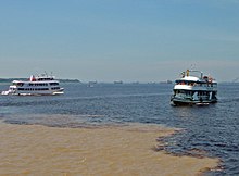
    Meeting of Waters; the confluence of Rio Negro (blue) and Rio Solimões (sandy) near Manaus, Brazil
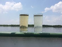
    Water samples of the Solimões (right) and Rio Negro (left)

    The Lower Amazon begins where the darkly colored waters of the Rio Negro meets the sandy-colored Rio Solimões (the upper Amazon), and for over 6 km (3.7 mi) these waters run side by side without mixing. At Óbidos, a bluff 17 m (56 ft) above the river is backed by low hills. The lower Amazon seems to have once been a gulf of the Atlantic Ocean, the waters of which washed the cliffs near Óbidos.

    Only about 10% of the Amazon’s water enters downstream of Óbidos, very little of which is from the northern slope of the valley. The drainage area of the Amazon basin above Óbidos city is about 5,000,000 km2 (1,900,000 sq mi), and, below, only about 1,000,000 km2 (390,000 sq mi) (around 20%), exclusive of the 1,400,000 km2 (540,000 sq mi) of the Tocantins basin.[48] The Tocantins River enters the southern portion of the Amazon delta.

    In the lower reaches of the river, the north bank consists of a series of steep, table-topped hills extending for about 240 km (150 mi) from opposite the mouth of the Xingu as far as Monte Alegre. These hills are cut down to a kind of terrace which lies between them and the river.[62]

    On the south bank, above the Xingu, a line of low bluffs bordering the floodplain extends nearly to Santarém in a series of gentle curves before they bend to the southwest, and, abutting upon the lower Tapajós, merge into the bluffs which form the terrace margin of the Tapajós river valley.[63]

    Mouth

    [edit]

    Satellite image of the mouth of the Amazon River, from the north looking south

    Belém is the major city and port at the mouth of the river at the Atlantic Ocean. The definition of where exactly the mouth of the Amazon is located, and how wide it is, is a matter of dispute, because of the area’s peculiar geography. The Pará and the Amazon are connected by a series of river channels called furos near the town of Breves; between them lies Marajó, the world’s largest combined river/sea island.

    If the Pará river and the Marajó island ocean frontage are included, the Amazon estuary is some 325 km (202 mi) wide.[64] In this case, the width of the mouth of the river is usually measured from Cabo Norte, the cape located straight east of Pracuúba in the Brazilian state of Amapá, to Ponta da Tijoca near the town of Curuçá, in the state of Pará.

    A more conservative measurement excluding the Pará river estuary, from the mouth of the Araguari River to Ponta do Navio on the northern coast of Marajó, would still give the mouth of the Amazon a width of over 180 km (112 mi). If only the river’s main channel is considered, between the islands of Curuá (state of Amapá) and Jurupari (state of Pará), the width falls to about 15 km (9.3 mi).

    The plume generated by the river’s discharge covers up to 1.3 million km2 and is responsible for muddy bottoms influencing a wide area of the tropical north Atlantic in terms of salinity, pH, light penetration, and sedimentation.[28]

    Lack of bridges

    [edit]

    There are no bridges across the entire width of the river.[65] This is not because the river would be too wide to bridge; for most of its length, engineers could build a bridge across the river easily. For most of its course, the river flows through the Amazon Rainforest, where there are very few roads and cities. Most of the time, the crossing can be done by a ferry. The Manaus Iranduba Bridge linking the cities of Manaus and Iranduba spans the Rio Negro, the second-largest tributary of the Amazon, just before their confluence.

    Dispute regarding length

    [edit]

    River taxi in Peru

    See also: Coastline paradox

    While debate as to whether the Amazon or the Nile is the world’s longest river has gone on for many years, the historic consensus of geographic authorities has been to regard the Amazon as the second longest river in the world, with the Nile being the longest. However, the Amazon has been reported as being anywhere between 6,275 km (3,899 mi) and 6,992 km (4,345 mi) long.[4] It is often said to be “at least” 6,575 km (4,086 mi) long.[3] The Nile is reported to be anywhere from 5,499 to 7,088 km (3,417 to 4,404 mi).[4] Often it is said to be “about” 6,650 km (4,130 mi) long.[22] There are several factors that can affect these measurements, such as the position of the geographical source and the mouth, the scale of measurement, and the length measuring techniques (for details see also List of rivers by length).[4][5]

    In July 2008, the Brazilian Institute for Space Research (INPE) published a news article on their webpage, claiming that the Amazon River was 140 km (87 mi) longer than the Nile. The Amazon’s length was calculated as 6,992 km (4,345 mi), taking the Apacheta Creek as its source. Using the same techniques, the length of the Nile was calculated as 6,853 km (4,258 mi), which is longer than previous estimates but still shorter than the Amazon. The results were reached by measuring the Amazon downstream to the beginning of the tidal estuary of Canal do Sul and then, after a sharp turn back, following tidal canals surrounding the isle of Marajó and finally including the marine waters of the Río Pará bay in its entire length.[60][25] According to an earlier article on the webpage of the National Geographic, the Amazon’s length was calculated as 6,800 km (4,200 mi) by a Brazilian scientist. In June 2007, Guido Gelli, director of science at the Brazilian Institute of Geography and Statistics (IBGE), told London’s Telegraph Newspaper that it could be considered that the Amazon was the longest river in the world.[24] However, according to the above sources, none of the two results was published, and questions were raised about the researchers’ methodology. In 2009, a peer-reviewed article, was published, concluding that the Nile is longer than the Amazon by stating a length of 7,088 km (4,404 mi) for the Nile and 6,575 km (4,086 mi) for the Amazon, measured by using a combination of satellite image analysis and field investigations to the source regions.[4] According to the Encyclopædia Britannica, the final length of the Amazon remains open to interpretation and continued debate.[3][25]

    Watershed

    [edit]

    Main article: Amazon basin

    The Amazon basin, the largest in the world, covers about 40% of South America, an area of approximately 7,050,000 km2 (2,720,000 sq mi). It drains from west to east, from Iquitos in Peru, across Brazil to the Atlantic. It gathers its waters from 5 degrees north latitude to 20 degrees south latitude. Its most remote sources are found on the inter-Andean plateau, just a short distance from the Pacific Ocean.[66]

    The Amazon River and its tributaries are characterised by extensive forested areas that become flooded every rainy season. Every year, the river rises more than 9 m (30 ft), flooding the surrounding forests, known as várzea (“flooded forests”). The Amazon’s flooded forests are the most extensive example of this habitat type in the world.[67] In an average dry season, 110,000 km2 (42,000 sq mi) of land are water-covered, while in the wet season, the flooded area of the Amazon basin rises to 350,000 km2 (140,000 sq mi).[64]

    The quantity of water released by the Amazon to the Atlantic Ocean is enormous: up to 300,000 m3/s (11,000,000 cu ft/s) in the rainy season, with an average of 209,000 m3/s (7,400,000 cu ft/s) from 1973 to 1990.[68] The Amazon is responsible for about 20% of the Earth’s fresh water entering the ocean.[67] The river pushes a vast plume of fresh water into the ocean. The plume is about 400 km (250 mi) long and between 100 and 200 km (62 and 124 mi) wide. The fresh water, being lighter, flows on top of the seawater, diluting the salinity and altering the colour of the ocean surface over an area up to 2,500,000 km2 (970,000 sq mi) in extent. For centuries ships have reported fresh water near the Amazon’s mouth yet well out of sight of land in what otherwise seemed to be the open ocean.[30]

    Despite this, the Atlantic has sufficient wave and tidal energy to carry most of the Amazon’s sediments out to sea, thus the Amazon does not form a significant river delta. The great deltas of the world are all in relatively protected bodies of water, while the Amazon empties directly into the turbulent Atlantic.[27]

    There is a natural water union between the Amazon and the Orinoco basins, the so-called Casiquiare canal. The Casiquiare is a river distributary of the upper Orinoco, which flows southward into the Rio Negro, which in turn flows into the Amazon. The Casiquiare is the largest river on earth that links two major river systems, a so-called bifurcation.

    Discharge

    [edit]

    Average discharge at the estuary; Period from 2003 to 2015: 7,200 km3/a (230,000 m3/s)[69][70]

    Year(km3)(m3/s)Year(km3)(m3/s)
    20036,470205,00020106,464205,000
    20046,747214,00020117,378234,000
    20056,522207,00020127,513238,000
    20067,829248,00020137,288231,000
    20077,133226,00020147,674243,000
    20087,725245,00020156,657211,000
    20098,200260,000

    Average discharge at Óbidos gauge station; Period from 1969 to 2018: 5,520 km3/a (175,000 m3/s)[69][70]

    Year(km3)(m3/s)Year(km3)(m3/s)
    19694,813152,50019946,184196,000
    19705,187164,40019954,887154,900
    19715,810184,10019965,685180,300
    19725,735181,70019975,336169,200
    19735,723181,35019984,713149,400
    19746,084192,80019995,860185,100
    19756,122194,00020005,735181,800
    19765,885186,50020015,536175,500
    19775,561176,20020025,598177,500
    19785,660179,40020035,387170,800
    19795,350169,50020045,207165,100
    19804,563144,60020055,104161,800
    19814,838153,30020065,825184,700
    19825,760182,50020075,490174,100
    19834,538143,80020086,090193,000
    19845,536175,40020096,264198,500
    19855,187164,40020105,233165,800
    19865,785183,30020115,568176,400
    19875,261166,70020125,877186,200
    19885,286167,50020136,083192,800
    19896,284199,10020146,212196,850
    19905,324168,70020155,890186,650
    19915,424171,90020165,025159,200
    19924,390139,10020175,710180,900
    19935,710180,90020185,685180,150

    Average discharge (Q – 173,000 m3/s) and sediment load (S – 754 x 106 ton/year) at Óbidos gauge station (period from 1996 to 2007)[71]

    YearQSYearQS
    1996180,3006722002177,500802
    1997169,2006912003170,800832
    1998149,4006522004165,100807
    1999185,8007322005161,800797
    2000181,8006922006184,700742
    2001175,5007872007174,100842

    Average, minimum and maximum discharge at Itacoatiara and Santarém (Lower Amazon). Period from 1998/01/01 to 2022/12/31 (Source: The Flood Observatory):[72][16]

    YearDischarge (m3/s)
    MinMeanMaxMinMeanMax
    ItacoatiaraSantarém
    199841,312139,002240,39669,202175,218278,306
    199964,130171,662288,86973,921182,266270,080
    200052,870161,345261,17673,306171,899275,060
    200130,670157,286256,62767,300173,517268,820
    200267,979164,171252,42592,711207,186296,805
    200382,556149,274228,998100,473182,767252,626
    200466,183139,926223,929100,986184,880265,644
    200557,598145,002258,38367,464172,411280,340
    200661,265168,975268,10891,126192,500301,860
    200774,679161,393238,83973,256192,715309,478
    200871,572168,065259,841101,146198,128316,669
    200959,298166,100275,54476,598204,920303,192
    201053,715128,035215,63872,101172,255255,208
    201142,192129,710230,29365,803155,030256,798
    201229,489172,103291,53750,070194,883323,680
    201351,341172,201286,87255,108206,295305,526
    201485,599192,462324,191151,997235,390338,905
    201566,094221,843339,83270,119261,580378,767
    201641,063167,746311,49469,995230,788367,296
    201760,218205,382329,771104,111223,193352,935
    201865,629202,838316,29195,376262,946386,022
    201996,549227,078340,21596,260260,664382,840
    202044,698214,586352,67172,955234,725388,213
    202185,862236,885354,79594,903262,264376,740
    202256,758214,763337,412101,693259,902405,999
    202338,496173,676304,33646,130217,551370,109
    Average59,532175,058284,17382,158208,303298,444

    Flooding

    [edit]

    NASA satellite image of a flooded portion of the river

    Not all of the Amazon’s tributaries flood at the same time of the year. Many branches begin flooding in November and might continue to rise until June. The rise of the Rio Negro starts in February or March and begins to recede in June. The Madeira River rises and falls two months earlier than most of the rest of the Amazon river.

    The depth of the Amazon between Manacapuru and Óbidos has been calculated as between 20 and 26 m (66 and 85 ft). At Manacapuru, the Amazon’s water level is only about 24 m (79 ft) above mean sea level. More than half of the water in the Amazon downstream of Manacapuru is below sea level.[73] In its lowermost section, the Amazon’s depth averages 20 to 50 m (66 to 164 ft), in some places as much as 100 m (330 ft).[74]

    The main river is navigable for large ocean steamers to Manaus, 1,500 km (930 mi) upriver from the mouth. Smaller ocean vessels below 9000 tons and with less than 5.5 m (18 ft) draft can reach as far as Iquitos, Peru, 3,600 km (2,200 mi) from the sea. Smaller riverboats can reach 780 km (480 mi) higher, as far as Achual Point. Beyond that, small boats frequently ascend to the Pongo de Manseriche, just above Achual Point in Peru.[62]

    Annual flooding occurs in late northern latitude winter at high tide when the incoming waters of the Atlantic are funnelled into the Amazon delta. The resulting undular tidal bore is called the pororoca, with a leading wave that can be up to 7.6 m (25 ft) high and travel up to 800 km (500 mi) inland.[75][76]

    Geology

    [edit]

    The Amazon River originated as a transcontinental river in the Miocene epoch between 11.8 million and 11.3 million years ago and took its present shape approximately 2.4 million years ago in the Early Pleistocene.

    The proto-Amazon during the Cretaceous flowed west, as part of a proto-Amazon-Congo river system, from the interior of present-day Africa when the continents were connected, forming western Gondwana. 80 million years ago, the two continents split. Fifteen million years ago, the main tectonic uplift phase of the Andean chain started. This tectonic movement is caused by the subduction of the Nazca Plate underneath the South American Plate. The rise of the Andes and the linkage of the Brazilian and Guyana bedrock shields,[clarification needed] blocked the river and caused the Amazon Basin to become a vast inland sea. Gradually, this inland sea became a massive swampy, freshwater lake and the marine inhabitants adapted to life in freshwater.[77]

    Eleven to ten million years ago, waters worked through the sandstone from the west and the Amazon began to flow eastward, leading to the emergence of the Amazon rainforest. During glacial periods, sea levels dropped and the great Amazon lake rapidly drained and became a river, which would eventually become the disputed world’s longest, draining the most extensive area of rainforest on the planet.[78]

    Paralleling the Amazon River is a large aquifer, dubbed the Hamza River, the discovery of which was made public in August 2011.[79]

    Protected areas

    [edit]

    NameCountryCoordinatesImagehideNotes
    Allpahuayo-Mishana National ReservePeru3°56′S 73°33′W[80]
    Amacayacu National ParkColombia3°29′S 72°12′W[81]
    Amazônia National ParkBrazil4°26′S 56°50′W[82]
    Anavilhanas National ParkBrazil2°23′S 60°55′W[83]

    Flora and fauna

    [edit]

    See also: Biodiversity of Colombia § Amazon natural region

    Flora

    [edit]

    See also the categories Flora of the Amazon and Trees of the Amazon rainforest

    Fauna

    [edit]

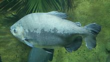
    The tambaqui, an important species in Amazonian fisheries, breeds in the Amazon River.

    See also: Category:Fauna of the Amazon

    More than one-third of all known species in the world live in the Amazon rainforest.[84] It is the richest tropical forest in the world in terms of biodiversity.[85] In addition to thousands of species of fish, the river supports crabs, algae, and turtles.

    Mammals

    [edit]

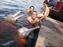
    Amazon river dolphin

    Along with the Orinoco, the Amazon is one of the main habitats of the boto, also known as the Amazon river dolphin (Inia geoffrensis). It is the largest species of river dolphin, and it can grow to lengths of up to 2.6 m (8.5 ft). The colour of its skin changes with age; young animals are gray, but become pink and then white as they mature. The dolphins use echolocation to navigate and hunt in the river’s tricky depths.[86] The boto is the subject of a legend in Brazil about a dolphin that turns into a man and seduces maidens by the riverside.[87]

    The tucuxi (Sotalia fluviatilis), also a dolphin species, is found both in the rivers of the Amazon basin and in the coastal waters of South America. The Amazonian manatee (Trichechus inunguis), also known as “seacow”, is found in the northern Amazon River basin and its tributaries. It is a mammal and a herbivore. Its population is limited to freshwater habitats, and, unlike other manatees, it does not venture into saltwater. It is classified as vulnerable by the International Union for Conservation of Nature.[88]

    The Amazon and its tributaries are the main habitat of the giant otter (Pteronura brasiliensis).[89] Sometimes known as the “river wolf,” it is one of South America’s top carnivores. Because of habitat destruction and hunting, its population has dramatically decreased. It is now listed on Appendix I of the Convention on International Trade in Endangered Species (CITES), which effectively bans international trade.[90]

    Reptiles

    [edit]

    The green anaconda is the heaviest and one of the longest known extant snake species.

    The anaconda is found in shallow waters in the Amazon basin. One of the world’s largest species of snake, the anaconda spends most of its time in the water with just its nostrils above the surface. Species of caimans, that are related to alligators and other crocodilians, also inhabit the Amazon as do varieties of turtles.[91]

    Birds

    [edit]

    See also: Category:Birds of the Amazon rainforest

    Fish

    [edit]

    Characins, such as the piranha species, are prey for the giant otter, but these aggressive fish may also pose a danger to humans.
    The neon tetra is one of the most popular aquarium fish.

    The Amazonian fish fauna is the centre of diversity for neotropical fishes, some of which are popular aquarium specimens like the neon tetra and the freshwater angelfish. More than 5,600 species were known as of 2011, and approximately fifty new species are discovered each year.[85]: 308 [40]: 27  The arapaima, known in Brazil as the pirarucu, is a South American tropical freshwater fish, one of the largest freshwater fish in the world, with a length of up to 4.6 metres (15 ft).[92] Another Amazonian freshwater fish is the arowana (or aruanã in Portuguese), such as the silver arowana (Osteoglossum bicirrhosum), which is a predator and very similar to the arapaima, but only reaches a length of 120 cm (47 in). Also present in large numbers is the notorious piranha, an omnivorous fish that congregates in large schools and may attack livestock. There are approximately 30 to 60 species of piranha. The candirú, native to the Amazon River, is a species of parasitic fresh water catfish in the family Trichomycteridae,[93] just one of more than 1200 species of catfish in the Amazon basin. Other catfish ‘walk’ overland on their ventral fins,[40]: 27–29  while the kumakuma (Brachyplatystoma filamentosum), aka piraiba or “goliath catfish”, can reach 3.6 m (12 ft) in length and 200 kg (440 lb) in weight.[94]

    The electric eel (Electrophorus electricus) and more than 100 species of electric fishes (Gymnotiformes) inhabit the Amazon basin. River stingrays (Potamotrygonidae) are also known. The bull shark (Carcharhinus leucas), a euryhaline species which can thrive in both salt and fresh water, has been reported as far as 4,000 km (2,500 mi) up the Amazon River at Iquitos in Peru.[95]

    Butterflies

    [edit]

    See also: List of butterflies of the Amazon River basin and the Andes

    Microbiota

    [edit]

    Freshwater microbes are generally not very well known, even less so for a pristine ecosystem like the Amazon. Recently, metagenomics has provided answers to what kind of microbes inhabit the river.[96] The most important microbes in the Amazon River are ActinomycetotaAlphaproteobacteriaBetaproteobacteriaGammaproteobacteria and Thermoproteota.

    Challenges

    [edit]

    The Amazon River serves as a vital lifeline for more than 47 million people in its basin and faces a multitude of challenges that threaten both its ecosystem and the indigenous communities dependent on its resources. According to the Office of the United Nations High Commissioner for Human Rights (OHCHR), the Yanomami, a tribe of approximately 29,000, struggles to preserve their land, culture, and traditional way of life due to encroaching illegal gold miners, malnutrition, and malaria. Meanwhile, in 2022, the region’s severe drought, has led to a devastating increase in water temperatures, reaching 39.1 degrees Celsius, causing the demise of 125 Amazon river dolphins.[97] This event displays the deteriorating environmental conditions and indicates the increasing vulnerability of the river’s ecosystem. In recent years, the Amazon River has experienced historically low water levels, the lowest in over a century. Brazil, the primary custodian of this invaluable natural resource, grapples with the challenges of mitigating the effects of this drought on communities and ecosystems, further emphasizing the urgency of sustainable environmental management and conservation efforts.[98]

    Major tributaries

    [edit]

    Solimões, the section of the upper Amazon River
    Aerial view of an Amazon tributary

    The Amazon has over 1,100 tributaries, twelve of which are over 1,500 km (930 mi) long.[99] Some of the more notable ones are:

    List of major tributaries

    [edit]

    The main river and tributaries are (sorted in order from the confluence of Ucayali and Marañón rivers to the mouth):

    Left tributaryRight tributaryLength (km)Basin size (km2)Average discharge (m3/s)
    Upper Amazon(Confluence of Ucayali and Marañón rivers  Tabatinga)
    Marañón2,112364,873.416,708
    Ucayali2,738353,729.313,630.1
    Tahuyo801,630105.7
    Tamshiyaçu86.71,367.386.5
    Itaya2132,668161.4
    Nanay48316,673.41,072.7
    Maniti198.72,573.6180.4
    Napo1,075103,307.87,147.8
    Apayaçu502,393.6160.9
    Orosa953,506.8234.3
    Ampiyaçu1404,201.4267.2
    Chichita481,314.287.7
    Cochiquinas492,362.7150.2
    Santa Rosa451,678101.5
    Cajocumal582,094.9141.5
    Atacuari1083,480.5236.8
    Middle Amazon(Tabatinga  Encontro das Águas)
    Javary1,05699,674.15,222.5
    IgarapéVeneza943.958.3
    Tacana54135.5
    Igarapé deBelém1,299.985.4
    Igarapé SãoJerônimo1,259.678.2
    Jandiatuba52014,890.4980
    IgarapéAcuruy2,462.1127.1
    Putumayo1,813121,115.88,519.9
    Tonantins2,955.2169.2
    Jutai1,48878,451.54,000
    Juruá3,283190,5736,662.1
    Uarini7,195.8432.9
    Japurá2,816276,81218,121.6
    Tefé57124,375.51,190.4
    Caiambe2,650.190
    Parana Copea10,532.3423.8
    Coari59935,741.31,389.3
    Mamiá5,514176.2
    Badajos41321,5751,300
    Igarapé Miuá1,294.556.9
    Purus3,382378,762.411,206.9
    Paraná Arara1,915.778.2
    ParanáManaquiri1,318.652.9
    Manacapuru29114,103559.5
    Lower Amazon(Encontro das Águas  Gurupá)
    Rio Negro2,362714,577.630,640.8
    Prêto da Eva3,039.5110.8
    Igapó-Açu50045,994.41,676.5
    Madeira3,3801,322,782.432,531.9
    Urubu43013,892459.8
    Uatumã70167,9202,290.8
    Canumã,Paraná do Urariá400127,1164,804.4
    Nhamundá,Trombetas744150,0324,127
    Curuá48428,099470.1
    Lago Grandedo Curuaí3,293.692.7
    Tapajós1,992494,551.313,540
    Curuá-Una31524,505729.8
    Maicurú54618,546272.3
    Uruará4,610.2104.8
    Jauari5,851108.3
    Guajará4,243105.6
    Paru de Este73139,289970
    Xingu2,275513,313.510,022.6
    IgarapéArumanduba1,819.950.8
    Jari76951,8931,213.5
    Amazon Delta(river mouth to Gurupá)
    Braco doCajari4,732.4157.1
    Pará78484,0273,500.3
    Tocantins2,639777,30811,796
    Atuã2,769119.8
    Anajás30024,082.5948
    Mazagão1,250.244.4
    Vila Nova5,383.8180.8
    Matapi2,487.481.7
    Acará,Guamá40087,389.52,550.7
    Arari1,523.680.2
    Pedreira2,00589.9
    Paracauari1,390.367.9
    Jupati724.232.6

    [100][101][102][103][104][17]

    List by length

    [edit]

    1. 6,400 km (4,000 mi)[3] (6,275 to 7,025 km (3,899 to 4,365 mi))[4] – Amazon, South America
    2. 3,250 km (2,019 mi) – Madeira, Bolivia/Brazil[105]
    3. 3,211 km (1,995 mi) – Purús, Peru/Brazil[106]
    4. 2,820 km (1,752 mi) – Japurá or Caquetá, Colombia/Brazil[107]
    5. 2,639 km (1,640 mi) – Tocantins, Brazil[108]
    6. 2,627 km (1,632 mi) – Araguaia, Brazil (tributary of Tocantins)[109]
    7. 2,400 km (1,500 mi) – Juruá, Peru/Brazil[110]
    8. 2,250 km (1,400 mi) – Rio Negro, Brazil/Venezuela/Colombia[111]
    9. 1,992 km (1,238 mi) – Tapajós, Brazil[112]
    10. 1,979 km (1,230 mi) – Xingu, Brazil[113]
    11. 1,900 km (1,181 mi) – Ucayali River, Peru[114]
    12. 1,749 km (1,087 mi) – Guaporé, Brazil/Bolivia (tributary of Madeira)[115]
    13. 1,575 km (979 mi) – Içá (Putumayo), Ecuador/Colombia/Peru
    14. 1,415 km (879 mi) – Marañón, Peru
    15. 1,370 km (851 mi) – Teles Pires, Brazil (tributary of Tapajós)
    16. 1,300 km (808 mi) – Iriri, Brazil (tributary of Xingu)
    17. 1,240 km (771 mi) – Juruena, Brazil (tributary of Tapajós)
    18. 1,130 km (702 mi) – Madre de Dios, Peru/Bolivia (tributary of Madeira)
    19. 1,100 km (684 mi) – Huallaga, Peru (tributary of Marañón)

    List by inflow to the Amazon

    [edit]

    RankNameAverage annual discharge (m^3/s)% of Amazon
    Amazon209,000100%
    1Madeira31,20015%
    2Negro28,40014%
    3Japurá18,6209%
    4Marañón16,7088%
    5Tapajós13,5406%
    6Ucayali13,5005%
    7Purus10,9705%
    8Xingu9,6805%
    9Putumayo8,7604%
    10Juruá8,4404%
    11Napo6,9763%
    12Javari4,5452%
    13Trombetas3,4372%
    14Jutaí3,4252%
    15Abacaxis2,9302%
    16Uatumã2,1901%